Places to visit while on board Knot Workin in the summer
Information presented on this page is for the page author's use only. Use of this information by anyone other than the author is offered as guidelines and non-professional advice only. No liability is assumed by the author or this web site. Regardless of information presented here, the captain is solely responsible for the safety of craft and crew.
(mouse over the map to see links. Click on link for more info)

Bay Bridge Boat Show Apr 15-17 2016
Annapolis Spring Boat Show, Apr 22-24 2016
National Maritime Day Commemoration in Baltimore at Pier 13 in Canton
Calvert County Watermen's Festival
Privateer Festival 16-17 Apr 2016
Portside Party, Sail Baltimore’s Summer Fundraiser 28 MayChestertown Tea Party May 27-29 2016; Chestertown, MD
Beer, Bourbon & BBQ Festival Jun 17-18 2016. National Harbor.
Chesapeake Crab and Beer Festival Jun 25, 2016. Baltimore Inner Harbor
Annapolis, Rotary Crab Feast, Aug. 5, 2016
Havre de Grace, Seafood Festival, 12-14 Aug 2016
Chesapeake Crab and Beer - National Harbor Aug 27, 2016. Washington DC
Sail Baltimore Tall Ships Schedule for Baltimore
Pirates & Wenches Fantasy Weekend Rock Hall, MD. Aug 12-14 2016.
Havre de Grace Seafood Festival Aug 7-9 2015 Havre de Grace
Patuxent River Appreciation Days 8-9 Oct 2016
Downrigging Weekend Oct 31 to Nov 2 2016. Chestertown, MD
Oct 6-10 2016 Annapolis sailboat show
Oct 13-16 2016 Annapolis powerboat show
Baltimore Portside Party 2 June 2016 at Baltimore Inner Harbor Visitor Center.
Friday night. After work we all travel to the boat's location east of Baltimore. On the way, we grab some take-out food then eat it in the comfort of the boat. The night aboard will give everyone their sea legs for the next day's trip.
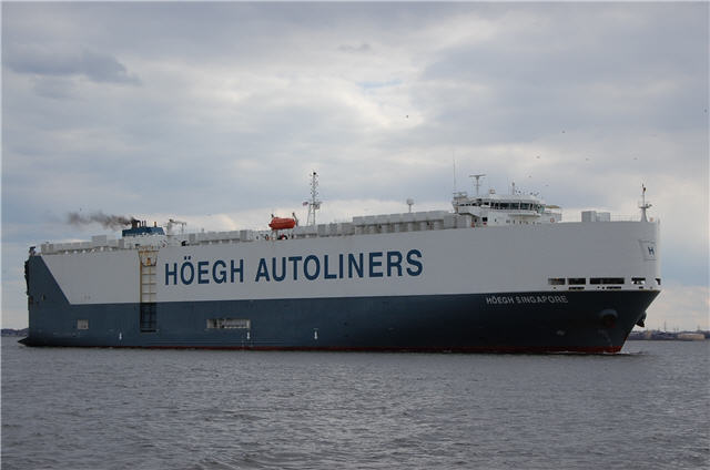
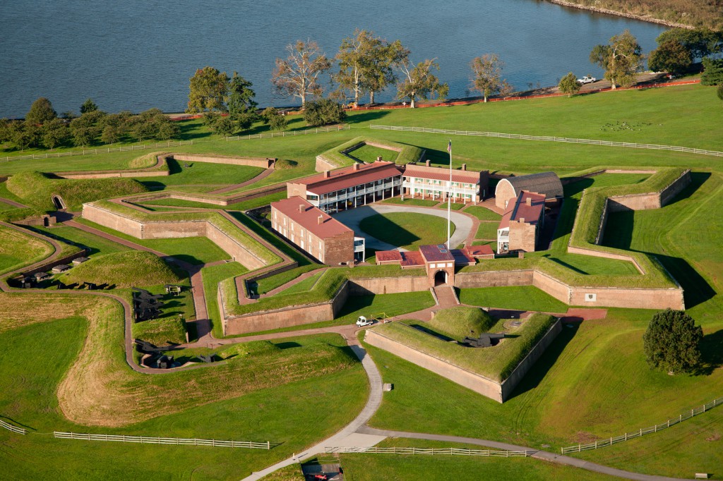
Saturday. After breakfast aboard, we depart the marina and head out into the Patapsco river toward Baltimore Inner Harbor. On the way, we will likely see large barges and other commercial ships traversing the harbor. Just after passing under the Key Bridge (Francis Scott Key), we head directly for Fort McHenry. We do a slow sail past Fort McHenry, and then head up the river for a leisurely cruise around the Inner Harbor. From the comfort of the heated / air conditioned cabin, you will get a water view of all the attractions the Inner Harbor has to offer. Next we sail past Ft McHenry to Curtis Cr to see the United States Coast Guard Yard Curtis Bay and other similar attractions. After the Curtis Bay tour, we travel under the Key Bridge toward the south shore of the Patapsco to White Rocks, where we dock at Mike's Crabhouse to visit their popular waterside restaurant and bar.
Saturday - option 1. We depart the marina early and head out into the Patapsco river toward Baltimore Inner Harbor. On the way, we will likely see large barges and other commercial ships traversing the harbor. We sail directly for the Inner Harbor and dock on the wall. Next we walk several blocks to Fells Point for Breakfast at Jimmy's. After breakfast we begin a slow crawl of browsing the shops beginning at Fells Point and ending at the Inner Harbor. After the Inner Harbor / Fells Point walking tour, we depart on Knot Workin and sail around the Inner Harbor and then slowly past Fort McHenry. Next we cruise to Curtis Cr to see the United States Coast Guard Yard Curtis Bay and other similar attractions. After the Curtis Bay tour, we travel under the Key Bridge toward the south shore of the Patapsco to White Rocks, where we dock at Mike's Crabhouse to visit their popular waterside restaurant and bar.
See Inner Harbor / Fells Point restrictions for information about boat anchoring and dinghy docking restrictions.
It is 161 nm (20 hrs @ 8.2 kn) from Old Bay to the mouth of the Chesapeake Bay. The first two to three days will be focused on getting to Norfolk. After a single day visiting Norfolk and Portsmouth, we will do an offshore excursion to Virginia Beach. Thereafter the boat will travel up the Chesapeake Bay stopping at various locations of interest along the way.
Many small creeks with marinas, restaurants, etc. Frog Mortar Creek, Sunset Cove, and Sue Cr are among the favorites. 39.296, -76.391. Red Eye Yacht Club is Sue Cr.
When it is hot, nothing beats a visit to the beach at Hart Miller Island. This popular boating destination is only 10 nm from Old Bay.
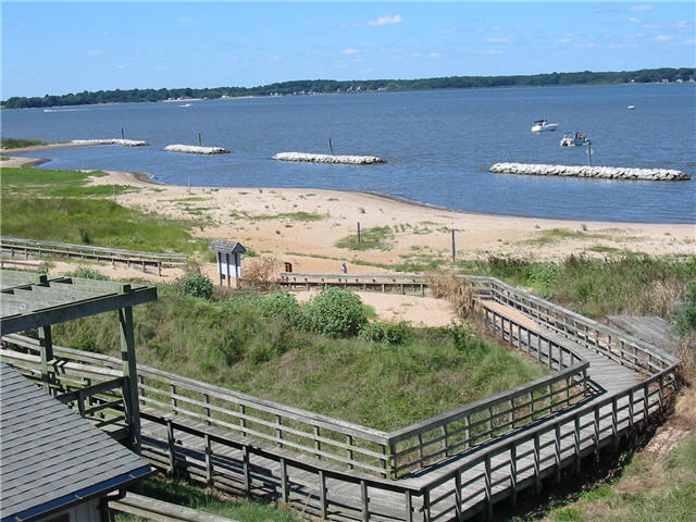
Another Saturday afternoon boater's favorite. A three hour ride (23 nm) gets you to this popular beach / bar / music hang out.
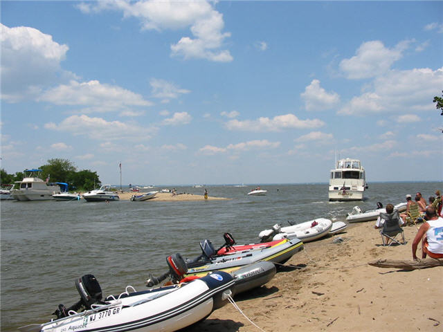
42 nm from Old Bay. Lloyd's Creek ath the mouth of the Sassafras has a party reputation. The entrance is hidden and therefore can be intimidating to newcommers. -39.377, -76.040.
45.4 nm from Old Bay
44.4 nm from Old Bay. Millard Tydings Memorial Park (39.537526, -76.088707). The Concord Point Lighthouse (39.540670, -76.084769). Tidewater Grill is on the water, 10 blocks north of the light house. Marina Tidewater $1.50/ft ph 410-939-0950
Six hours or 46.5 nm from Old Bay. See page #2 of the North East Strolling Guide for information on the town of North East (shops, restaurants, etc.).
The C & D Canal is 17 nm long (2 hrs @ 8.2 kn). It is about 40 nm (5 hrs @ 8.2 kn) from the C & D Canal exit to the Delaware river to Philadelphia. The C&D starts at 39.5231, -75.8749 up the Elk Rvr. Chesapeake City is 1/3 of the way to the Delaware Bay. About ½ distance on a branch off to the left is a marina with the Aqua Sol Restaurant on site (39.5481, -75.7047). The C&D canal exits to the Delaware at 39.5606, -75.5632.
It is 10 nm from the North East to Havre de Grace along the north coast (Sea Doo). Otherwise it is 17 nm following the channel from the North East to Haver de Grace.
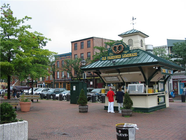
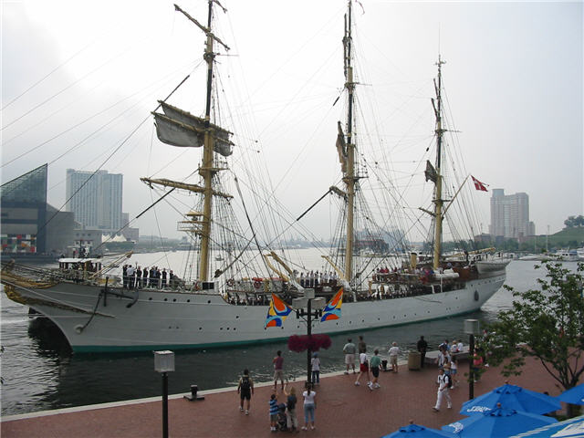
Since the summer of 2014 it is no longer possible for recreational boaters to short term dock on the wall at Fells Point. The area is now aggressively by the harbor police who are polite, but stern. The only alternative is to pay for docking a considerable distance up the river at Inner Harbor and then walk up to Fells Point. Gone are the days when you could visit for a few hours, shop, eat lunch, and depart.
Don't be confused by some of the incorrect information on the internet about docking and landing a dinghy in the Baltimore Inner Harbor from sources such as BoatingInBaltimore.com. You cannot land a dinghy for free at any location in the Inner Harbor or Fells Point. The water taxi dock at the Torsk submarine has a sign that clearly states that you may not dock a dinghy at that location. If you do, the Baltimore Marine Police may impose a $250 fine against you.
If you frequently visit the Inner Harbor, you can purchase an annual dinghy landing permit for $5 from the Harbormaster. This allows you to land a dinghy between Piers 3 and 4 (National Aquarium & Pier 5 hotel). BUT, the allowed anchoring locations throughout the no wake zone are so limited now, you won't have a place to anchor your boat. As a result, you will need to pay for docking on the wall or at one of the overpriced marinas, negating the need to land a dinghy at this single location.
The Savannah is the first nuclear powered merchant ship. It will built in the 1950's to promote the peaceful use of nuclear energy. She was in service from 1962 to 1972 as one of only four nuclear powered cargo ships ever built.
The ship at is open to public tours at Pier 13, Canton Marine Terminal, Baltimore MD on a limited schedule. See the N.S. Savannah website for the schedule. More information is also available at nssavannah.net. See their calender of events.
Travel an easy 45 minutes (4.9 nm) across the Patapsco River to Rock Cr.
Anchor out and dink to Mike's Restaurant
located at White Rocks Marina. .
From the outside bar at Mike's, you have a great view of Rock Creek.
White Rocks Marine live cam
Maryland Marina nearby provides fuel.
Travel 1 hour up Bear Cr and anchor nearby the Hard Yach Cafe. Swim and Sea Doo, then dink into the Hard Yacht Cafe on the water for live entertainment and cocktails. The Hard Yacht Cafe is on the premisis of the Anchor Bay East Marina.
.jpg)
.jpg)
Curtis Cr is off of the south shore of the Patapsco Rvr. As you move up the river you see many abandoned boats including the wooden ships, schooners (including the William T. Parker), an old side-wheeled steamer (Emma Giles), a concrete ship (the General Morgan Lewis), an an old tug. The William T. Parker schooner earhed the nickname Gost ship of Baltimore when after being abandoned, it traveled from North Carolonia to Main, and back again, without crew.
Beyond the turnstile railroad bridge on the north shore lies the United States Coast Guard Yard Curtis Bay. This facilty opened in 1899 and is the only site for building, repair, and overhaul of USCG vessels. The annual budget is reported to be around 100 million dollars. The yard also manufactures all of the buoys and channel markers for the US coastal waters. You can usually see one or more of the high speed boats, including 40+ knot jet-propelled interceptors.
Curtis Bay Depot was built in 1918 by the U.S. Army. Previously it was the home of the Defense Logistics Agency (DLA).
An Army Reserve unit the 949th Transportation Company resides in the area. It holds a barge crane that can offload battle tanks from the decks of the lagest U.S. Naval cargo ships. A secondary responsibilty is salvage operations, clearning port channels, and removing obstructions.
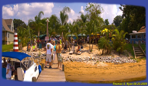
Up Curtis Cr off you find a place called The Rams Head Dockside (formerly Reckless Ric's) with a sandy beach and palm trees. The food is very good. The dock is small and the water shallow.
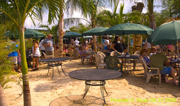
Travel two hours (18 nm) to Rock Hall Harbor for lunch. Continue up to Swan Creek, anchor out, and then dink/walk/shuttle bus to town. The town has a few small shops. Rock Hall Harbor has two popular restaurants. Neither restaurant offers much of a happy hour for food/drinks during the week.
Rated #1 4th of July Celebration by Chesapeake Bay Magazine
Rock Hall Marine Consignment Center Located it the Rock Hall Harbor at the Rock Hall Clam House 21083 Chesapeake Ave., Rock Hall, MD 21661 From Swan Creek, take Rock Hall Ave SE to S. Hawthorne Ave and then make a right and go south.
Only one marina in the Swan Cr area is friendly to boats that anchor in Swan Cr
Home of Red Eyes Dock Bar. This is a great place to sip a drink and watch the boats go through the channel. A good intermediate stop on the way to St Michaels, the Corsica River, or Chestertown.
Depart Old Bay and travel two hours (17 nm) to Kent Narrows. Stop for lunch and drinks. Continue two hours (15 nm) to Corsica River and anchor for the afternoon and evening. Depart the next morning early and travel four hours back to Old Bay.
Travel 5.0 hours (20+21 nm) from Old Bay to Chestertown. Visit the waterfront restaurant for lunch, then walk and explore the town. Option to sail 15 nm to the Corsica River to anchor overnight, and then 35 nm (4.3 hours) back to Old Bay the next day. Option to stop at Kent Narrows (Red Eyes) for lunch.
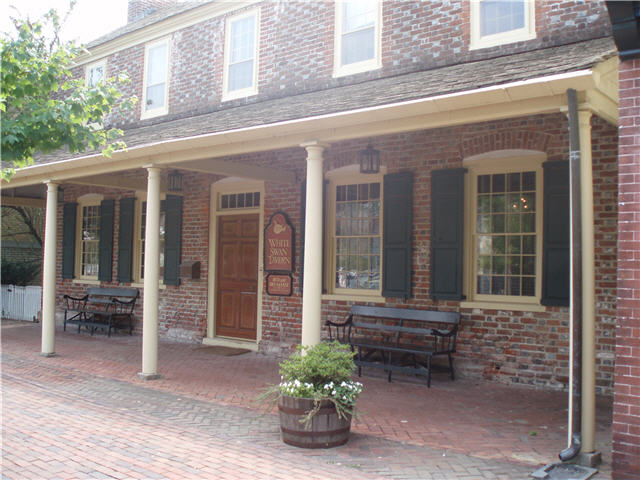
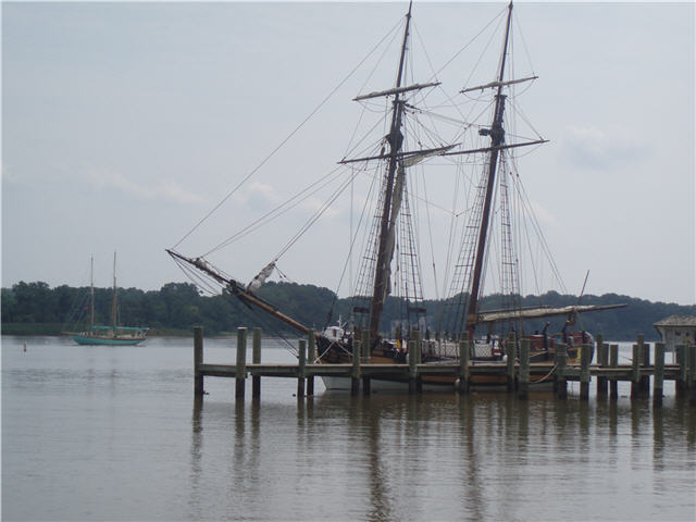
A short distance up the Chester River past Kent Narrowsis Queenstown Creek. At the top of the Little Queenstown Creek is a set of docks close to the tiny town. It is reported to accommodate a a transient overnight if you contact the town offices at 410-827-7646 during working hours.
Travel 1 hour (7.9 nm) from Old Bay to Bodkin Cr. Anchor out and then dink in to Cheshire Crab Restaurant at Pleasure Cove Marina. If you call them, they will send a water taxi out to pick you up and deliver you to their restaurant.
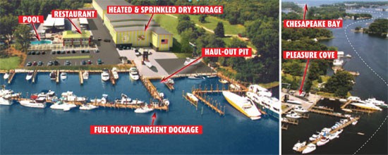
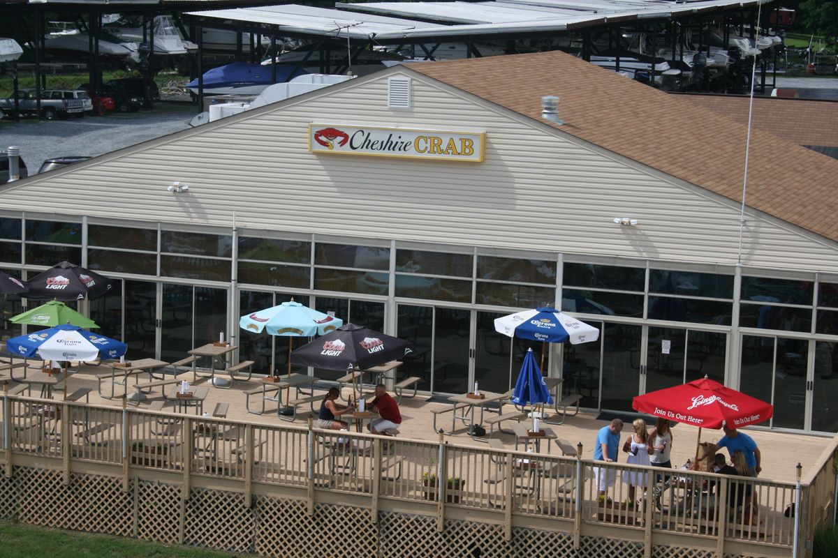
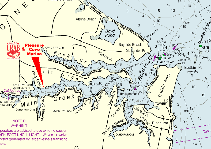
Cheshire Crab Restaurant at Pleasure Cove Marina is one of the few places (as of Aug 2015) that offers a free water taxi ride from your boat or home to the restaurant on Saturday and Sunday during the summer months. Request water taxi pickup by calling 410-360-2220 or VHF69. Pleasure Cove Marina also offers all day pool passes. latitude 039.07.578 N and longitude 076.28.356 W.
A short 15 nm sail from Old Bay to the Dobbins Isl beach within the Magothy River. Bring the Sea Doo along to explore the entire river, or use the dinghy.

Depart Old Bay early and travel two hours (16 nm) to the Bay Bridge, passing Sandy Point Park. Continue another 45 minutes(6 nm) to Annapolis. Pickup a mooring for the night, then take the dinghy out to explore the local rivers by water. Tour the US Naval Academy.
.jpg)
.jpg)
The Sunday service at the USNA Chapel beginning at 11 am is highly recommended.
Car Parking in Annapolis. Parking in Annapolis can be expensive and a challenges. My best recommendation is to park at Knighton Garage ($10/day; 1A colonial Ave; just off of West St, a few blocks from the Ram's Head). The Annapolis Circulator is a city operated trolley that provides service between four parking garages around the business district. Cost is $1.00/ride. Operates every 20 minutes. Monday through Saturday – 7:30 a.m. to 11:00 p.m. Sunday - 8:00 a.m. to 8:00 p.m.
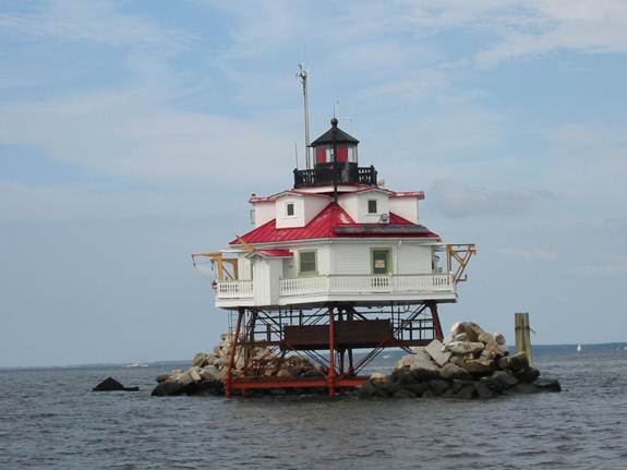
Sail three hours (25 nm) from Old Bay to the Thomas Point Light House just outside the entrance to the South River. Continue another hour (8 nm) and explore the entire length of the South River. Anchor out and then visit the local restaurants by dinghy. Option to fish along route.
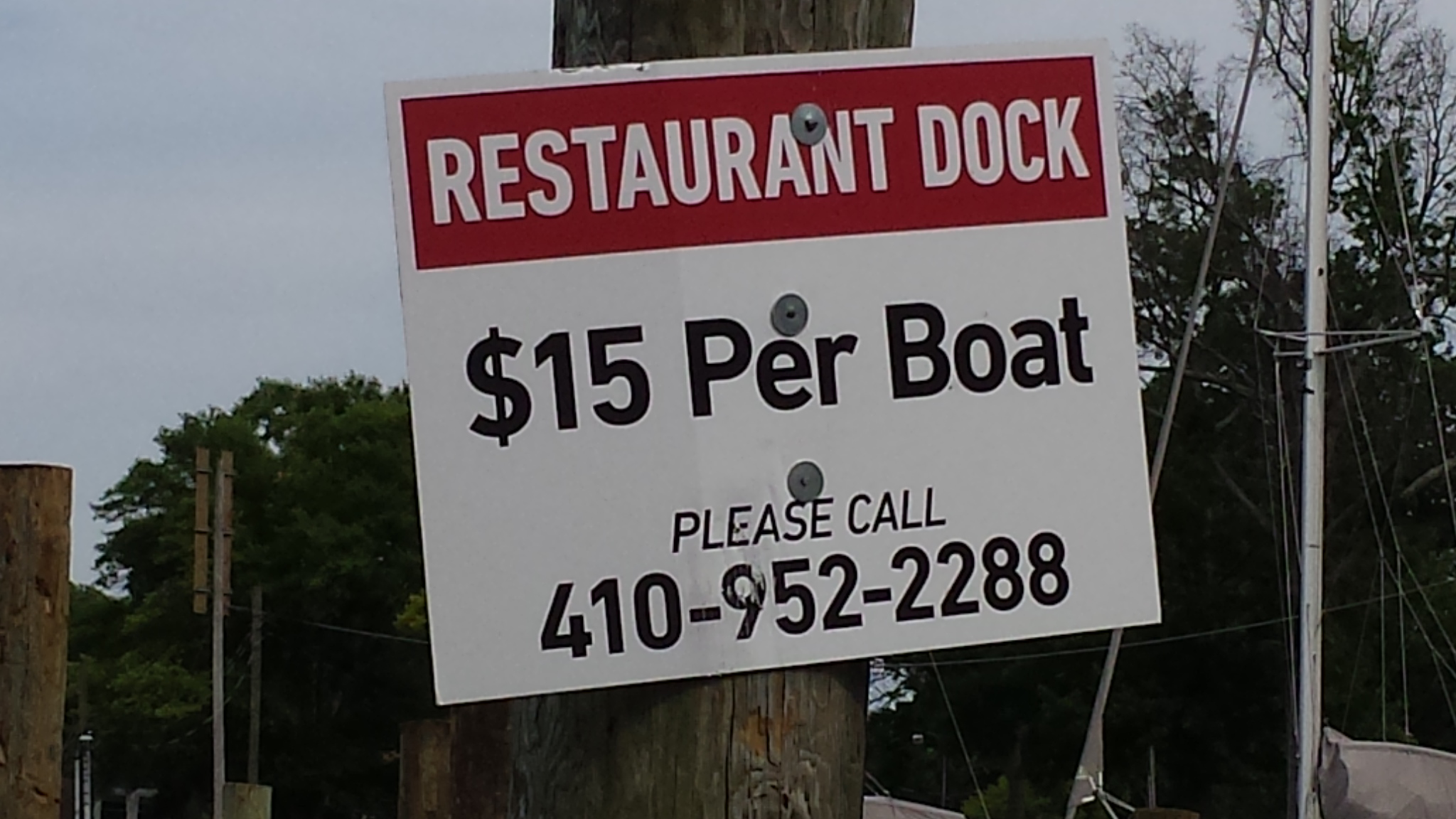
WARNING - appparently boaters are not welcome at The Pier Oyster Bar by boat. As of 2017 they now impose a $15 fee just to dock your boat!
St. Michaels has a waterfront and town rich with activity. The Chesapeake Bay Maritime Museum is a great visit. See the St Michaels Business Association for more information. The Harbor Shuttle (VHF 71 or 410-924-2198) provides water taxi service.
.jpg)
Eastern Shore Brewing Co 605 S Talbot St, Saint Michaels (walk down Talbot St 1.5 blocks past Shore Pedal & Paddle)
Depart Old Bay by 10am and travel 2 hours (17 nm) to Kent Narrows. Stop for lunch and drinks. Then continue another 1.5 hours (12 nm) to St Michaels. Visit St Michaels for the afternoon and evening. Depart early the next day and travel 3.5 hours back to Old Bay. Note it is 16 nm longer to go around Kent Isl.
Depart Old Bay and travel 5 hours (34 nm) to St. Michaels via Bay Bridge and south of Kent Island. From St. Michaels, it is 3 hours to Annapolis.
Unfortunately the marinas within the small harbor are priced unreasonably high for the typical transient boater. St Michaels Marina LLC; St Michaels Harbor Inn; Higgins Yacht Yard Inc; CBMM.
Depart Old Bay early and travel three hours (25 nm) to Thomas Point Light House. Then continue another hour (7.3 nm) to the Rhode River and anchor out. By dinghy cruise down to the West River restaurants such as Pirates Cove. Option to visit the Captain Salem Avery House (Museum open Su 1-4 pm Mar to Dec or by appointment, grounds open dusk to dawn).
The Captain Salem Avery House Museum property consists of the main house with additions; three sheds formerly used as bath houses; and a modern boathouse built in 1993, featuring the locally built EDNA FLORENCE, a 1937 Chesapeake Bay deadrise workboat. The two-story house consists of the original residence, constructed about 1860, which was later expanded the 19th century and in the 1920s.
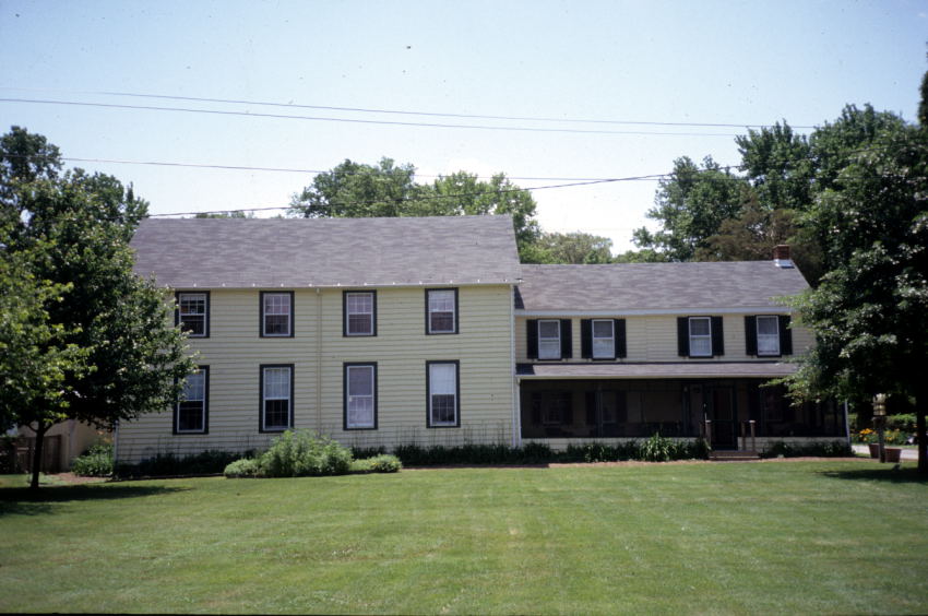
Tilghman Isl is ~10 nm from the Thomas Point Light House (4 hours / 35 nm from Old Bay). On the northern shore the island is joined to the land by Knapps Narrows bridge. From the west through Knapps Narrows, you reach Dogwood Harbor on the north east shore of the island. Several restaurants and museums are on the Knapps Narrows / Dogwood Harbor end of the island.
The Knapps Narrows draw bridge clearance is only 12' feet. We will need to hail them on VHF 13 and request them to raise the bridge for us. Shoaling to 5.0 feet has been reported on the east side of the Knapps Narrows channel during MLW. Shoaling has been reported on the west end of the channel at 3 to 4 feet during MLLW.
East of Poplar Isl on the west shore of Tilghman Isl (Ferry Cove) is Lowes Warf Marina Inn, offering a restaurant, and marina supplies.
Poplar Isl is on the south west shore of Tilghman Isl and 6.7 nm from the Thomas Point Light House. Traveling another 14 nm around to the south east side of Tilghman Island and then North will get you to Dogwood Harbor.
Up Harris Creek is the Harrison House Country Inn and Harrison's Chesapeake House where they specialize in oysters. Overnight dockage is available ($50, plus $10 for electric); dockage for dining is available, first-come-first-served. Rooms run $115-$130. 410-886-2121;www.chesapeakehouse.com
Herring Harbor South marina is the main marina at the south end of this bay. About one mile south is North Beach, and another mile south is Chesapeake Beach. More like a resort than a marina, with transient dockage rates adjusted accordingly.
Several transient dockage options available, but all pricy at $2.00 to $2.25/ft.
Town Cr has room for 2-3 boats to anchor. Dinghy access is out on the Tred Avon River at the town dock directly across from Robert Morris Inn. There is also a dinghy dock to the left of the Hinckley yard in the harbor. Optionally anchor at nearby Flatty Cove or Goldsborough Cr to the east.
No interesting shopping. A few resturants.
The harbor (Cambridge Cr) at Cambridge is the second deepest port in Maryland and has an extensive maritime history. Tie the dinghy up to the pilings at the ladders on the City dock. Bridge opens on demand. VHF-FM channel 16 and works on channels 13 and 68; call sign KZA-695; telephone 410-228-8311. Cambridge Cr is in my opinion too narrow to anchor in. Transient dockage available at Cambridge Yacht Club or Cambridge Municipal Yacht Basin for $1.50/ft. Both are to starboard as you are about to enter the harbor. Farmer's Market on Thursday 3-6 has fresh crab, veggies, fruits, breads and handmade items.
A few shops are on Locust St between High St and Muir St.
Try a beer at RAR Brewery (504 - 506 Poplar St) taproom / brewery.
Bay Country Antiques at 415 Dorchester Ave set in a massive warehouse in Cambridge's old industrial district.
Locals like Cindy's East Side Kitchen located at 3127 Aireys Rd.
Solomons Island is 47 nm from the Bay Bridge, or 67 nm (8 hrs) from Old Bay. Solomons Isl features a great anchorage and local marina services. Zahniser's Yacht Center is one of the few places where you can land your dinghy and pay a nominal fee ($3.00). Zahniser's Yacht Center also offers mooring balls ($30/day). Up the river about 9 nm you may visit Sotterley Plantation and Vera's Beach Club.
Transient dockage for $1.50/ft at Calvert Marina ph 410-326-4251
Rated #3 4th of July Celebration by Chesapeake Bay Magazine
Vera's Beach Club features a beach bar and entertainment platform. Boaters anchor out across from the beach to enjoy the free music. A large restaurant sits on the hill above the beach.
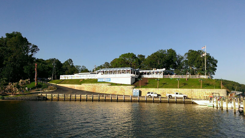
Sotterley Plantation is accessible from the water. A small dock can be found on the north entrance. On the property are a sawn-log slave quarters of circa 1830, an 18th-century brick warehouse, and an early-19th-century brick meat house. Farm buildings include an early-19th-century corn crib and an array of barns and work buildings from the early 20th century.
Tiki Bar is rated #1 Northern Bay dockside bar by Chesapeake Bay Magazine
CD Cafe' along Solomons Isl Rd is rated #5 romantic restaurant by Cheaspeake Bay Magazine.
Stoney's Seafood House is rated #3 Northern Bay restaurant for crab cakes by Chesapeake Bay Magazine. Up the Patuxent River on the north shore. Sits on the water.
Dennis Point Marina on the St Marys River $1.50/ft transient dockage. ph 301-994-2288
Transient dockage for $1.50/ft at Point Lookout Marina ph 301-872-5000 located on Smith Cr.
![]() Interactive NOAA chart of the area
Interactive NOAA chart of the area
Leonardtown MD is about 25 nm up the Potomac River, near Brenton Bay. The small town offers shops, galleries, restaurants, etc. Transient boaters can tie their dinks to the town dock at Leonardtown Warf Park. Leonardtown hosts the U.S. Oyster Festival each Fall.
National Harbor has 150 stores and 30 restaurants. Map of National Harbor area
Smith Island — a Methodist colony settled by British colonists from Cornwall in the early 1700s. It is just off of the eastern shore of the lower Chesapeake Bay, just north of the MD VA border. 37.9813, -76.0538 Lunch is available at several restaurants on the island. The water around Smith Isl is shallow and few if any anchroages are available.
Very shallow. Do not approach by boat without local knowledge.
A ferry goes between Point Lookout (10:30 am, $40/pp) and Crisfield (12:30 pm, $26/pp) to Smith Island
It is 30 nm (< 4 hrs) from Smith Isl to Solomons Isl
East of Smith Island lies Rumbley Marina & Dock Bar (Goose Crrek Pit & Pub). 38.092718, -75.862059
Anchoring within Somers Cove.
A ferry goes between Crisfield (12:30 pm, $26/pp) and Smith Island
No anchorage. Docking at Parks Marina for $35/night w/ electric. Tangier Isl has a small town and airport. Tour the island by bicycle.
Just south of Smith Point is Ingram Bay. On the North Shore go up Cockrell Cr. Within Cockrell Cr you can find many anchorages and nearby marinas. Anchoring near the Crazy Crab restaurant is tight.
Readville Fishermen's Museum rated #5 by Chesapeake Bay Magazine. open weekends Saturday 10:30 to 4:30, Sunday 1 to 4
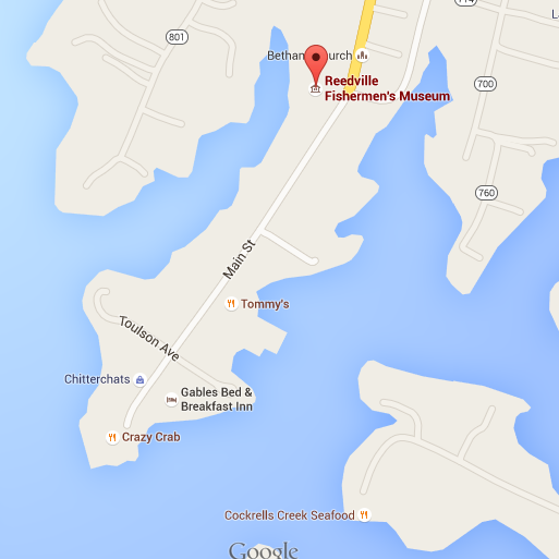
Several restaurants on water in the area, including the Chesapeake Bay recommended Crazy Crab (for crab cakes) which sits right on the water. The Reedville Marina coincident with the Crazy Crab offers reasonable price transient docking (ph 804-436-3081). Also see Tommy's restaurant. (crab balls, full bar). and other recommendations at Smith Point Seafood
Smith Isl is 17 nm away. Carter Cr (Rappahannock Rvr) is 26 nm away.Carter Cr is on the north shore of the Rappahannock River. The area is a good anchorage with several restaurants and marinas nearby. 26 nm from Carter Cr to Ingram Bay.
The Tides Inn rated #3 Southern Bay romantic dinner restaurant by Chesapeake Bay Magazine. Located in Carter Creek .
Merroir is #4 dockside bar by Chesapeake Bay Magazine. Located at Locklies Cr (anchor for night provided no east / north east wind, otherwise travel across Rappahannock Rvr to Carter Cr).
Pelican's Bar & Grill rated #2 Southern Bay dockside bar by Chesapeake Bay Magazine. This restaurant is on site at The Windmill Point Marina. Located at White Stone VA, just at the north end of the mouth of the Rappahannock River. The entrance is very small and doesn't appear to support anchoring. No anchoring nearby except right on the Rappahannock River (exposed from every direction except North).
Take Jackson Cr toward Deltaville Marina / Boatyard. Anchorage at 37.55058, -76.33383. Shopping and restaurants along General Puller Hwy (including a West Marine store).
Cocomo's is rated #3 dockside bar by Chesapeake Bay Magazine (no website or other reference found on web).
J&W Seafood rated #1 for Southern Bay steamed crabs by Chesapeake Bay Magazine. Along General Puller Hwy (a significant distance from the water).
The Deltaville Oyster Company. Read great article " Adventure On The Half Shell" talks about this company. Not a restaurant.
Deltaville Maritime Museum is rated as the #4 maritime museum by Chesapeake Bay Magazine.
Crabs at J&W Seafood. Deltaville, VA (rated #1 for Southern Bay steamed crabs by Chesapeake Bay Magazine)
It is 15 nm from Deltaville to Carter Cr (Rappahannock Rvr)
Deltaville Yachting Center located on Broad Cr. Access via Rappahannock Rvr (north of Deltaville) a 100 ft wide channel with 7 ft depth. $1.00/ft transient dockage for BoatUS member. ph 804-776-9898 No diesel. Approach map
Located on the western shore of the Chesapeake Bay, south of Deltaville, and north of Norfolk. Cape Charles on the eastern shore of the bay is to the east and slightly south of Mobjack Bay.
Marinas Compass Marina on the East River, Mobjack Marina on the North River, and Severn River Yachting Center on the Servern River. The Severn Yachting Center is located up a river with what appears to have several good anchorage locations nearby.
Boaters have access to YorkTown via the public Riverwalk Landing. According to Chesapeake Bay Magazine: 1200 feet of dockage; $5 for 4 hours; $1.75 per foot overnight; $25 per mooring.; Strong currents and winds encourage many boats to seek refuge at Sarah Creek York River Yacht Haven. Sarah Creek York River Yacht Haven offers courtesy car to boaters for exploration.
JamesTown and Yorktown Settlement Victory Center
Riverwalk Landing along the Yorktown VA waterfront
Located on the eastern shore of the Chesapeake Bay. You need to follow a long and narrow channel to get to Kings Cr. The only marina option in Kings Cr is Kings Cr Marina. $1.80/ft. Kings Cr is a well protected anchorage, but likely too narrow for anchoring. You must follow the approach map. 26 nm from Hampton VA across the Bay to Cape Charles. 26 nm from Cape Charles to Deltaville Va.
An oyster farm sits right on Kings Cr. The Oyster Farm Seafood Eatery at Kings Creek (attached to marina?).
website with local information
Aqua Restaurant is at the Kings Creek Marina & Resort. The restaurant (recommended romantic dinner location by Chesapeake Bay Magazine) sits right on the Bay, with the front facing the Bay, and the back Kings Creek. 37.27938, -76.01106 The town of Cape Charles (37.26823, -76.01101) is a 1 mile walk just south of Kings Cr and has shopping and other restaurants. Try Kelly's Gingermut Pub.
Town Harbor (Cape Charles Harbormaster) 2015 rates were $5.00/hr (2 hr min.). $1.75/ft overnight. Phone: 757-331-2357
Cape Charles Yacht Center is in the Town Harbor, on the left as you enter. A nice restaurant call the Chanty is on the marina grounds. Most of the restaurants and shops are along Mason Street. ph 757-331-3100 37.2678 N, 76.0178 W
Annual Cape Charles Clam Slam and Boat Docking Festival, July 31 to August 2.
Just north of Hampton / Norfolk on the west shore is the Poquoson River.
Down Bennett Cr is two restaurants easily accessible to boaters from White House Cove. Owens Restaurant Surf Rider Restaurant
You can pickup an airboat ride from Jamie Moore at the dock at Whitehouse Cove (Bennett's Creek). 1 hour for $50/pp.
Plum Tree Island National Wildlife Refuge
Sail up the Elizabeth Rvr to Tidewater Yacht Marina and get fuel, then dock at Waterside Marina. Overnight dockage $1.50/ft. Electric $5/night. Use the ferry system to visit Portsmouth from Norfolk. I don't see a way to visit Hampton by ferry, so must use bus or move our boat.
Norfolk Naval Station. 40 min bus tour for $10/pp. Tours daily depart at 11:00am; 12 noon; 1:00pm and 2:00pm.
Nauticus Nauticus admission includes access to selected interior areas of the Battleship Wisconsin. $16 to $35/pp. 10am - 5pm all week. Winconsin guided tour at 11 am, 1pm, 3pm ($35 gold ticket).
USS Wisconsin see Nauticus 45-60 min
Hampton Roads Naval Museum (in Norfolk, not Hampton)
Portsmouth is across the Elizabeth River from Norfolk. The historic district Olde Towne can be reached by ferry from Norfolk. HRT operates three 150-passenger ferries on the Elizabeth River between Norfolk and Portsmouth. Pickup the ferry the 'waterside' stop right at the marina.
Portsmouth Naval Shipyard Museum. One block from the waterfront and three blocks from the paddle-wheel ferry landing. $4/2 adults.
Most of the shops are concentrated along High St. Skipjack Nautical Wares & Marine Gallery (moving in August).
The anchorage at Hospital Point in Portsmouth puts you in the middle of everything. It may be wake choppy at times.
NO FERRY BETWEEN HAMPTON AND NORFOLK. Bus available. Unsure how to get around the Hampton area to visit Fort Monroe, etc.
Fort Monroe National Monument Free.
Anchorage past Settlers Landing Bridge has 4.5 ft at low water, 6 ft otherwise. Room for ~3 boats. Good protection. Sometimes mined with crap pots.
Old Point Comfort Marina is right at Ft Monroe. $1.50/ft Boat US members.
Hampton Public Piers Slip layout. $1.50/ft Floating concrete docks. Best location - short walk to Downtown Hampton’s historic district, restaurants, and local attractions. VA Air & Space Center nearby.
Hampton Yacht Club $1.50/ft 15 min walk to stores & restaurants.
It is 34 nm (4.5 hrs) from Norfolk / Waterside Marina to Lake Rudee / Virginia Beach. Ride bikes short distance to the Virgina Beach Boardwalk. Vertical clearance is 28 feet at the double bridges.
NOAA buoy at Cape Henry VA (just north of Virginia Beach) has wave height data.
![]() Interactive NOAA chart of the area
Interactive NOAA chart of the area
The Virginia Aquarium & Marine Science Center is a dink ride on Lake Rudee, or a short bike ride.
The anchor area on Lake Wesley is too narrow as an anchorage. Try landing dingy at the Virginia Beach Fishing Center charter boat docks for shore access. 2nd alt is Fishermans Warf Marina (has dinghy dock). Alt 3 is to try to tie up at back side of the fuel dock at Rudees Inlet Station Marina.
Virginia Beach Fishing Center. 757-491-8000 $2.00/ ft. Also nearby Rudee Inlet Station Marina and Fishermans Warf Marina.
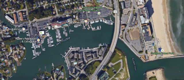
The Virginia Aquarium & Marine Science Center is a dink ride on Lake Rudee or a bike ride away.
The Light rail runs from Norfolk to Virginia Beach. From the marina at Norfolk, pickup the bus on Waterside Drive
Video of Knot Working sailing into Rudee Inlet. https://vimeo.com/135927032
Chesapeake Bay fishing on Knot Workin
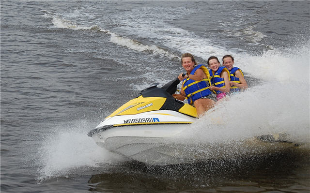
As of summer 2017 the Sea Doo is no longer in service
The original tour with a stop at Fells Point for lunch and shipping is no longer available as of Summer 2014 because the Baltimore City Government has restricted any short term docking at Fells Point. This unfortunate changes is a result of a few boaters "squatting" their boats for extended periods on the walls, the city has initiated a campaign to restrict boaters from docking in the Fells Point area (except for the marinas of course). The area according to the Baltimore dockmaster is not under their jurisdiction, but it is clearly monitored aggressively by the harbor police. The harbor police are polite, but stern. The only alternative is to pay for docking all the way in at Inner Harbor and then walk up to Fells Point.
Friday night. After work we all travel to the boat's location east of Baltimore. On the way, we grab some take-out food then eat it in the comfort of the boat. The night aboard will give everyone their sea legs for the next day's trip.
Saturday. After breakfast aboard, we depart the marina and head out into the Patapsco river toward Baltimore Inner Harbor. On the way, we will likely see large barges and other commercial ships traversing the harbor. Just after passing under the Key Bridge (Francis Scott Key), we head directly for Fort McHenry. We do a slow sail past Fort McHenry, and then head up the river for a leisurely cruise around the Inner Harbor. From the comfort of the heated / air conditioned cabin, you will get a water view of all the attractions the Inner Harbor has to offer. Next we sail past Ft McHenry to Curtis Cr to see the United States Coast Guard Yard Curtis Bay and other similar attractions. After the Curtis Bay tour, we travel under the Key Bridge toward the south shore of the Patapsco to White Rocks, where we dock at Mike's Crabhouse to visit their popular waterside restaurant and bar.
Saturday - option 1. We depart the marina early and head out into the Patapsco river toward Baltimore Inner Harbor. On the way, we will likely see large barges and other commercial ships traversing the harbor. We sail directly for the Inner Harbor and dock on the wall. Next we walk several blocks to Fells Point for Breakfast at Jimmy's. After breakfast we begin a slow crawl of browsing the shops beginning at Fells Point and ending at the Inner Harbor. After the Inner Harbor / Fells Point walking tour, we depart on Knot Workin and sail around the Inner Harbor and then slowly past Fort McHenry. Next we cruise to Curtis Cr to see the United States Coast Guard Yard Curtis Bay and other similar attractions. After the Curtis Bay tour, we travel under the Key Bridge toward the south shore of the Patapsco to White Rocks, where we dock at Mike's Crabhouse to visit their popular waterside restaurant and bar.
It is 35 nm (5 hrs) from Knot Workin's marina (Old Bay) to St. Michaels.
If the wind is 10 knots or more and from the north, we will travel from sunrise to noon to St. Michaels. Walk the town, visit the shops and have lunch Then travel 28 nm (3 hrs) from St. Michaels to Annapolis. After picking up a mooring in Annapolis, we will dink in and walk the town, visiting the various shops. Later, we can have dinner at any of the tasty restaurants. In the morning, we can attend the Protestant church service at the Naval Academy beginning at 11 am. in the 'USNA Chapel' We need to get off the mooring ASAP so we will travel 2.5 hours back to Knot Workin's marina (Old Bay).
If the wind is 10 knots or more and from the south, we will have breakfast aboard Knot Workin and then enjoy excursions on the Sea Doo. Around noon we will depart and travel to St. Michaels. Walk the town, visit the shops, and have lunch Thereafter we will travel north to the Wye River to a comfortable anchorage and enjoy a peaceful night in a quite area.
Travel 1 hour to Bodkin Creek. Anchor out and either swim and Sea Doo. Later, dink in to Cheshire Crab Restaurant at Pleasure Cove Marina for a drink while listening to live music. After dark take a cruise around the river on the dink.
Travel 2 hours to Dobbins Isl on the Magothy Rvr. Swim and Sea Doo. & Eat lunch, then depart early afternoon and travel 2 hours to Annapolis. Dink in and visit the town for late afternoon and evening. Optional visit to Naval church service on Sunday.
Places on the Chesapeake Bay you can visit by boat, and stay overnight in a hotel.
Pirates Cove Marina. &nbap; email: PiratesCoveMd@Gmail.com ph 410-867-3600
Surf Rider (Hampton, Va.) ???
The Deltaville Oyster Company. Read great article "Adventure On The Half Shell" talks about this company.
The Thames Street Oyster House in Fells Point, Maryland.
When the wind is 10 knots or more, it is better to plan the trip so the wind is with the tidal current, not against it. When the wind is against the tidal current, the waves get sharp, tall, and uncomfortable. The tidal flood current is at a maximum beginning 1.5 hours before high tide, and at a minimum two hours after high tide. The tidal ebb is a maximum beginning 1.5 hours before low tide, and a minimum two hours after low tide.
If wind from the north, travel during the ebb beginning beginning 1.5 hours before low tide.
If wind from the south, travel during the flood beginning beginning 1.5 hours before high tide.
![]() Interactive NOAA chart of the area
Interactive NOAA chart of the area
Sitemap | Mobile website | Open Database License
Web site by www.MechatronicSolutionsLLC.com | | Mobile device NOT detected | 1.4950 ms
